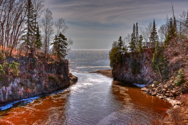
Temperance River State Park Take the trail that winds along the edge of the Temperance River gorge!
Temperance River State Park
temperance river
Park Highlights
- Rock Climbing
- Hiking
- Very Scenic Along River
- Fishing
- Camping (Year Around)
- Rocky Landscape
Temperance River State Park Quick Stats
- 5,007 acres
- 275,931 annual visits
- 22,720 overnight visits
Fishing
In the spring you can catch Steelhead and Longnose suckers near the mouth. In the fall, you can catch Salmon near the mouth as well. Further upstream and in the tributaries you can catch brook, browns and rainbow trout. Some of the tributaries are the spot to catch larger brook trout, like Heartbreak Creek and Cedar Creek. Follow the Temperance up north of Tofte and you will find more tributaries worth the time. Check out the map link below to see what the DNR has put together. Remember to always check the regulations.
Temperance River History
Pierre Esprit Radisson and Medard Chouart, Sier des Groselliers, were probably the first white visitors to the North Shore when they traveled up the shore of Lake Superior during 1660. Along with the Ojibwe Indians, the French controlled the North Shore area until 1763. The first white settlers in the area were probably clerks at American Fur Company posts located along the shore in the 1830s. It is said the park got its name because, unlike other North Shore streams, the river had no bar at its mouth. At one time, the waters of this particular river flowed so deep and so strong into Lake Superior that there was no build-up of debris. This meant that there was no “bar.” What could you call a river without a bar? For an appropriate, if slightly tongue-in-cheek selection, “temperance” fits perfectly. The area became a state park in 1957. Campsites on both sides of the river, plus the park’s hiking trails and picnic areas, draw a steady stream of visitors to this North Shore park.
Temperance River Geology
The bedrock in this park is all igneous (solidified from the molten state), and formed about 1.1 billion years ago. One of the most interesting features in the park is the narrow Temperance River gorge with its many waterfalls. The steep-gradient river has cut through the fractured, ancient lava flows of the river bed. Swirling water carried gravel and rocks which wore away the basalt and created large potholes. Over thousands of years, these potholes were dug deeper and wider, eventually connecting and creating the deep, narrow gorge. Nearby, more potholes were left high and dry as the river found its new, lower channel. Carlton Peak, the high knob in the northeastern part of the park, is made of a hard, massive rock called anorthosite. It consists of several huge blocks of this rock, which were carried up from many miles below the surface by the molten basalt lava.
Remember – Don’t Move Firewood!
Burning non-local firewood can spread invasive species, and it’s against Minnesota state law. Always buy your firewood at the park, or from an approved local vendor.
Phone Number (218) 663-7476
Temperance River State Park Page
North Shore Trout Map
Other Photos Taken By Randen Pederson
All State Park Information the property of the Minnesota DNR.
Photography the property of Randen Pederson


