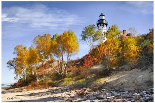
Au Sable Light Station
Au Sable Light Station
Pictured Rocks State Park, MI
Located within Pictured Rocks National Lakeshore, this light stands on Au Sable Point on the south shore of Lake Superior, approximately 12 miles west of Grand Marais, Michigan.
Built in 1873-1874, the light tower’s base diameter is 16 feet with a height of 87 feet. The lens focal plane is 107 feet above lake level. A fog signal building was built in 1897.
The original two-story keepers dwelling was attached to the light tower in the back. In 1909, the building was added on to the front so it would accommodate two families. One lived upstairs, one down. The head keepers residence was built in 1909.
Visiting the Au Sable Light Station
To visit the Au Sable Light Station, travel to the Hurricane River Campground located 12 miles west of Grand Marais on Alger County Road H-58. Park in the day use parking area near the bridge. It is a 1-1/2 mile walk (one way) to the lighthouse. Walk the hiking trail to the east beginning at the picnic area near the Hurricane River mouth. The trail is on the historic U.S. Coast Guard road to the light station. Be alert for occasional vehicle traffic.
On the beach below the trail, exposed shipwreck remains dot the shoreline. Watch for the signs and steps to the beach along the trail.
NOTE: Bicycles and pets are not permitted on this trail and at the light station.
Phone Number (906) 387-3700
More InformationThe Lake Superior coastline between Whitefish Point and Grand Island stands as one of the most beautiful stretches of shoreline in all of the Midwest. Centered in this stretch of coastline, towering sandstone cliffs stand sentinel, their multicolored faces painted with rich streaks of vivid color, and their surfaces carved into otherworldly forms by the ceaseless action of the lake over the millennia. Small wonder that the Federal Government would eventually select the area as its first National Lakeshore in 1966, to ensure that the area’s natural beauty would remain unspoiled for generations to come. – Seeing The Light – terrypepper.com – compete info at link below
All content the property of Ontonagon County Historical Society. Great Photo the property of G. Hoffman. More information quote and source the great work of Terry Pepper.


