Brule River Boreal Forest (No. 160)
Brule River Boreal Forest (No. 160)
Brule River Boreal Forest State Natural Area Brule River Road Maple, WI 54854
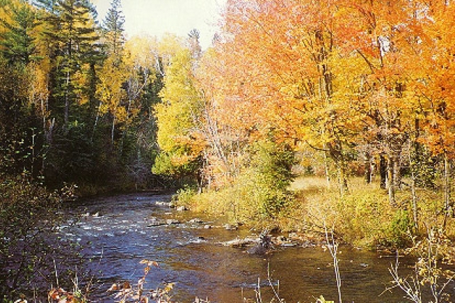
Situated along the steep slopes and terraces bordering the Brule River is a boreal forest in various stages of recovery. The most mature stands feature large, white pine, white spruce, balsam fir, balsam poplar, and occasionally white cedar on the slopes. White spruce is reproducing well. The younger stands are generally aspen dominated with paper birch being a significant component of more disturbed stands. Shrubs include alder, northern bush honeysuckle, early low blueberry, and round-leaved dogwood. Characteristic herbs are large-leaved aster, wild sarsaparilla, twinflower, lady fern, bracken fern, wild strawberry, American starflower, and Canada mayflower. Noteworthy plants found within the boreal forest include rabbit-berry, purple clematis (Clematis occidentalis), vasey rush (Juncus vaseyi), and arrow-leaf sweet colt’s-foot (Petasites sagittatus). Terraces along this stretch of river support swamp hardwood stands composed of black ash and red maple, alder thicket, and stands of emergent marsh in old abandoned oxbows. In a steep-sided ravine along a tributary to the Brule is a mature forest of large to medium white spruce and balsam fir. Understory plants include wood anemone, dwarf red raspberry, bunchberry, and hairy wood rush. Small spring areas along the creek drain the ravine and support chestnut sedge, sprengel’s sedge, Michigan lily, and rabbit-berry. Resident birds are black-throated green, pine, and Nashville warblers, ovenbird, and hermit thrush. Rare animals found within the area include the bald eagle (Haliaeetus leucocephalus). Brule River Boreal Forest is owned by the DNR and was designated a State Natural Area in 2003.
The Brule River Boreal Forest is located within the Brule River State Forest, Douglas County. T49N-R10W, Sections 10, 15, 22, 23, 27. 652 acres.It is owned by the WDNR
Access
The area is best seen by canoe. Put in at Highway 13 canoe landing and canoe downstream through the natural area. Walk-in access is available from numerous parking areas located along Brule River Road – north and west of Highway 13.
Map Of Area
Allowable Activities In Area
- Hiking
- Fishing
- Cross country skiing
- Hunting
- Trapping
- Scientific research (permit required)
- Outdoor education
- Wild edibles (What is this?)
- Pets (Rules)
- Wildlife viewing
Prohibited Activities In Area
- Horseback riding
- Rock climbing
- Vehicles, including bicycles, ATVs, aircraft, and snowmobiles except on trails and roadways designated for their use
- Collecting of animals, non-edible fungi, rocks, minerals, fossils, archaeological artifacts, soil, downed wood, or any other natural material, alive or dead. Collecting for scientific research requires a permit issued by the DNR
- Collecting of plants including seeds, roots or other non-edible parts of herbaceous plants such as wildflowers or grasses
- Camping and campfires
- Geocaching
Directions
8450 E Camp Amnicon Rd South Range, WI 54874– Take Highway 2 East (also 53 South) out of Superior. Exit on Highway 13, — 1 mile outside of Superior (also the Apostle Islands National Lakeshore exit). Turn left at the top of the exit ramp onto Highway 13. Turn left at S. Camp Amnicon Road (also Amnicon Falls State Park sign). After 2.5 miles, the dirt road splits. Veer right at the split. When you get to the end of the road, you’re here!
Phone Number (715) 364-2602
Forest Website
Friends of the Brule
All content the property of Wisconsin State Natural Areas Program and WDNR. Photography the property of www.friendsofthebrule.com


