Port Wing Boreal Forest
Port Wing Boreal Forest
Port Wing, Wisconsin
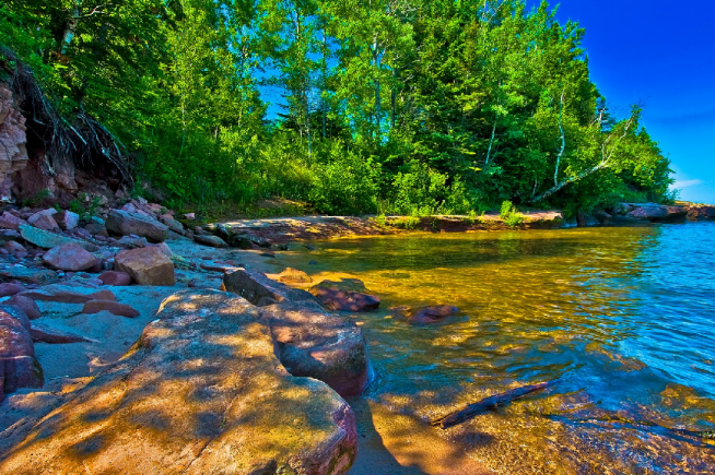
Port Wing Boreal Forest encompasses two areas of northern dry-mesic forest on sand spits inland from the present Lake Superior shoreline. The forest has distinct boreal characteristics. Large white and red pines (to 30” diameter) form a canopy over white spruce, balsam fir, red maple, white birch, mountain maple, yellow birch, and white cedar. The ground layer contains blueberries, twinflower, yellow blue-bead-lily, large-leaved aster, three-leaved gold-thread, and several club-mosses. Resident birds in the forest are very diverse and include veery, solitary vireo, northern parula, blackburnian warbler, redstart, purple finch, and white-throated sparrow. Between the forested sand spit and the beach to the north is a wetland complex of northern sedge meadow, shrub swamp and bog containing typical bog species such as pitcher plant, sundews, bladderworts, and sedges. Alder thickets are found around the bog. The wetlands are an extension of the estuary of the Flag River, the watercourse that separates the two natural area units. Two rare plants and two rare invertebrates inhabit the wetlands: leafy white orchis (Platanthera dilatata), common bog arrow-grass (Triglochin maritima), black meadowhawk dragonfly (Sympetrum danae) and bog copper butterfly (Lycaena epixanthe). The 20-acre beach and dune complex along the Lake Superior shoreline is dominated by marram grass, blue-joint, Canada wild rye, beach pea, and sand cherry. The beach is used extensively by shorebirds and waterfowl. Port Wing Boreal Forest is owned by the DNR and was designated a State Natural Area in 1979.
Directions
From the intersection of Highway 13 and Washington Avenue in Port Wing, go north on Washington Avenue. Turn left on Quarry Rd to reach the Western section. Continue until road turns into Lakeview Rd and follow it until you reach the Easter section. — For the east unit: from the intersection of County Highway A and State Highway 13 in Port Wing, go east on 13 about 1.6 miles, then west on Lakeview Road 0.2 miles, then north on Big Pete Road about 0.5 miles to Lake Superior. For the west unit: from the intersection of Washington Avenue and 13 in Port Wing, go north on Washington Avenue 0.6 miles, then west on Quarry Road about 1 mile, then north on Point Road 0.25 miles to a parking area.
Forest Info – WDNR
All content the property of the Wisconsin DNR. Photography the property of Okuto at https://ssl.panoramio.com/user/3715715.


