Tettegouche State Park
Tettegouche State Park
Tettegouche State Park
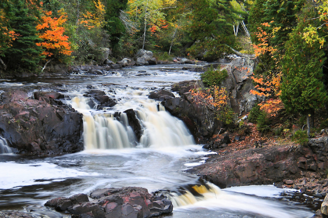
Come to Tettegouche for a great sense of the North Shore: the spectacular overlooks at Shovel Point; rocky, steep cliffs and inland bluffs; the cascading 60 ft. High Falls of the Baptism River; and the historic Tettegouche Camp where visitors can stay the night. This is a hiker’s paradise with miles of trails that overlook the Sawtooth Mountains and wind down to inland lakes accessible only by foot. The Palisade Valley Unit features broad scenic vistas coupled with an expanse of multi-use, four-season trails. Two more trout lakes complement the fishing opportunities within the rest of the park. The park is also known for rock climbing opportunities and quality birdwatching in the spring, summer, and especially the fall.
Highlights:
- Waterfalls
- Hiking
- Rock Climbing
- Wildlife / Peregrine Falcons
- Year-Round Camping
- Cross-Country Skiing
- Cabins
Lodging
History
In 1898, the Alger-Smith Lumber Company began cutting the virgin pine forests of Northeastern Minnesota. A logging camp was set up on the shores of a lake the loggers called Nipisiquit, an Indian name from a tribe in New Brunswick, Canada, the logger’s native country. They took the Algonquin names for New Brunswick landmarks and gave them to the lakes in Tettegouche.
In 1910, after removing most of the Norway and white pine, the logging company sold the camp and surrounding acreage to the “Tettegouche Club,” a group of businessmen from Duluth who used the area as a fishing camp and retreat. One of its members, Clement Quinn, bought the others out in 1921 and continued to act as protector for the area until 1971 when Quinn sold Tettegouche to the deLaittres family. The deLaittres continued Quinn’s tradition of stewardship for the land, beginning negotiations several years later for the preservation of Tettegouche as a state park. During these years, the Nature Conservancy, a private land conservation organization, played a vital role (along with other concerned individuals and groups) in the transfer of ownership. Finally, on June 29, 1979, legislation was enacted establishing Tettegouche as a state park.
Geology
The North Shore of Lake Superior is a combination of rock cliffs, pebble beaches, and bold headlands. The landscape owes its character to the erosion of bedrock by running water and glaciers, and especially to the glacial excavation of the Lake Superior basin. Glacial action resulted in thin soils and numerous rock outcroppings. The North Shore drainage pattern is one of short, steep rivers with many waterfalls and deeply eroded gorges. Some present-day features, however, are the result of much older geologic processes. About 1.1 billion years ago, North America began to spread apart along a rift that extended from what is now Lake Superior all the way to Kansas. The deep-sourced basaltic lava that poured out of this rift formed virtually all of the bedrock of the North Shore. Removal of lava from beneath what is now Lake Superior caused the flows to tilt to the southeast. Spectacular examples of these lava flows are Palisade Head and Shovel Point. These are made of rhyolite, a light-colored volcanic rock that contrasts with the more common, dark basalt along the rest of the shore.
Phone Number (218) 353-8800
Tettegouche State Park Home Site Tom Dempsey Photography Reservations Tettegouche State Park Map
Content the property of Tettegouche State Park and MN Department of Natural Resources. Photography the property of Tom Dempsey.


